Day Three
The next morning, I was pleased to find (i) another excellent Holiday Inn Express breakfast and (ii) that the Montana 600 snagged 8 or 10 satellites almost immediately. I set off to locate Iron Gate, VA and the headwaters of the famous James River. This involved guiding the remarkably patient Z4 down the steep and rocky Head of the James Road, whereupon I was solidly on Private Property. Fortunately, I located the ownera nice old fellow (who was, uh, about my age)and had an enjoyable talk with him. He told me a lot about the area and invited me to follow one of his tractor paths down to the river.
There I found the Cowpasture River (on the left in this photo) and the Jackson River (on the right), where they come together to form the James.

The James River then proceeds downstream for 348 miles, on its way to the Chesapeake Bay and the first English colony in America, namely the Jamestown settlement of 1607.

Over the years, the Cowpasture and Jackson Rivers have washed quite a collection of stones to their confluence. I managed to find a couple of (probable) Indian artifacts without even trying.

Back in Iron Gate, I found other artifacts, in the form of this old home

and the vacant Iron Gate School. The town is apparently quite serious about keeping tramps, vandals, and roving photographers out of the school: Note that the windows have all been filled in with cement blocks! Note, too, that the little window in the top gable seems to have been pushed out slightly from the insideperhaps by some poor soul who got cemented inside the school and, with her last ounce of strength, was trying to escape?


Okay, an active imagination is not really a prerequisite for BMW touring; but it doesnt hurt!
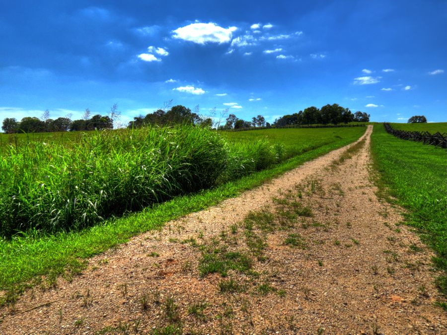
Back on the road, I set my sights for Interstate 81 and home, enjoying the heavy-duty clouds along the way.

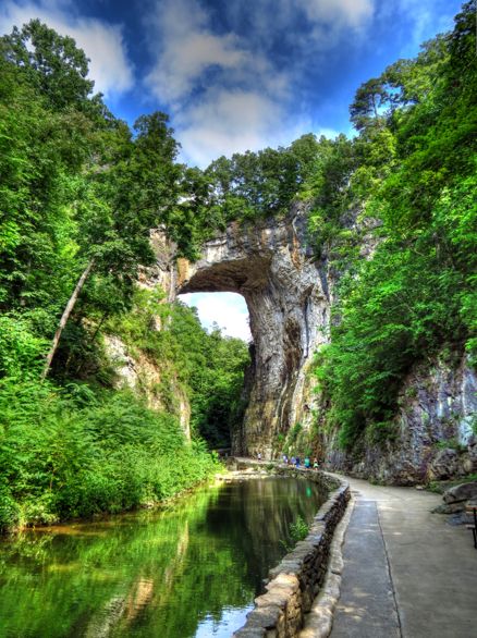
When I got to I-81, however, I turned south instead of north. After all, if youre this close to the Natural Bridge, and if you havent seen it since you were 14, then you should probably make a side trip there. I was a little surprised to find that Route 11 still passes right across the bridge. Youd think that decades of car and truck traffic might jeopardize the integrity of this majestic rock formation, but apparently it hasnt.
The Natural Bridge looked identical to my memories. More than 500 million years ago, it was part of a large limestone cavern, carved by Cedar Creek. Over time, the other parts of the cavern eroded and collapsed, leaving a 215-foot-high section of the tunnel roof. A young George Washington surveyed this area in about 1750 and engraved his initials in two places. In 1774, Thomas Jefferson bought 157 acres of property from King George III, including Natural Bridge, for 20 shillingsequivalent today to about $160! (And you thought only the Native Americans were cheated in various land deals
) Remember Frederic Edwin Church, the painter mentioned in my report
Almost Heaven: The Hudson River Valley? Heres his 1852 painting of Natural Bridge, along with my modern photo.

The Natural Bridge visitors center now has an indoor butterfly garden. Its important to watch where you step, since the little buggers are everywhere. I believe these are owl butterflies. They were happily feeding when I arrived, but they agreed to pose for an HDR photo.

Back on I-81 and heading north, finally, I soon approached Winchester, VA. It occurred to me that I could stop by the
Museum of the Shenandoah Valley for a quick tour. (As documented in
Before There Were Interstates, it was just closing when I tried to visit before.) The museums exhibits were great, and I especially enjoyed the fantastic model houses created by R. Lee Taylor. As indicated in these iPhone photos, its pretty hard to distinguish his scale-model rooms from the real thing.


The Glen Burnie mansion is still closed for renovations, but its historic gardens were open, statues and all.


As I drove by Charles Town, WV towards Harpers Ferry, I remembered that I had one more piece of unfinished business. Detouring onto Millville Road near Harpers Ferry, I found a largely unknown section of the Harpers Ferry National Historic Park and set off on foot to the top of this ridge. Why bother on such a hot day?
Because Id spotted the ruins of Jacob Allstadts original farmhouse, naturally! Readers with unusually good memories will recall that Jacob, his son John, and their seven slaves were taken hostage by John Browns raiders and held captive at the firehouse at Harpers Ferry. Fortunately, all of them survived the subsequent attack by Federal forces led by Thomas Jackson. Three years later, and then known as Stonewall, Jackson was back, this time to capture the Union armory at Harpers Ferry. He set up a substantial artillery force along Schoolhouse Ridge, which, together with artillery at Maryland Heights and Loundon Heights, poured fire onto the Union troops and led to the relatively quick surrender of 12,000 soldiers.
Anyway, Jacob Allstadts farmhouse was situated on South Schoolhouse Ridge, and Id read that its ruins were still there. Sure enough

Although the house has deteriorated significantly even since this Library of Congress photo in 2009, recent efforts have stabilized the ruins.


With one last look at my longsuffering BMW, it was time to press on for home.

All told, my trip encompassed a little over 900 miles, including getting to the Roanoke area and back. It was a wonderful opportunity to explore what used to be, examine some of the most twistacious drivers roads Ive ever encountered, and to exercise an outstanding sports car. What more could I ask for?
Rick F.