Quote:
Originally Posted by Petrosexual

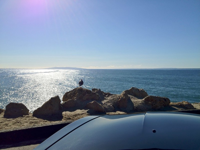
Here's one more from the set; that's Catalina Island in the distance:
 |
Petro - thanks!! That is a great photo! I can almost hear the surf and feel the warmth of the sun. As much as I am digging that image, I think the only thing I will be digging in a day or so is a tunnel to get out of the house. Here is my local forecast:
Watches
St. John's and vicinity
5:32 AM NST Wednesday 09 January 2013
Winter storm watch for
St. John's and vicinity continued
Heavy snow and reduced visibilities in blowing snow will develop Thursday afternoon.
This is an alert to the potential development of dangerous winter weather conditions in these regions. Monitor weather conditions..listen for updated statements.
An upper trough currently over Northern Ontario will track northeastward today and is forecast to spawn the development of a low pressure centre near p.E.I early Thursday morning. This low will begin to intensify as it tracks south of Newfoundland Thursday night, and is then expected to drift slowly southeastward over the Grand Banks on Friday.
For the Southwest Coast from Burgeo to the Connaigre Peninsula: heavy snow will develop on Thursday morning. Strong winds and heavy snow will combine in the afternoon to give reduced visibilities in blowing snow. Snowfall amounts of 15 centimetres are expected by Thursday evening.
For Clarenville,Terra Nova, and the Avalon, Bonavista and Burin peninsulas: A winter storm watch has been issued for the approaching system. Snow is forecast to develop on Thursday afternoon, becoming at times heavy by the evening. Winds will strengthen through the day and will combine with the falling snow to give
reduced visibilities in blowing snow.
Conditions will continue to deteriorate through the night, with winds reaching near 100 km/hour on Friday and total snowfall amounts possibly reaching 40 to 60 centimetres by Friday night. For these regions, the brunt of the storm still lies just outside the short range forecast period; the public is advised to monitor future forecasts as these watches will be upgraded to warnings later today.